
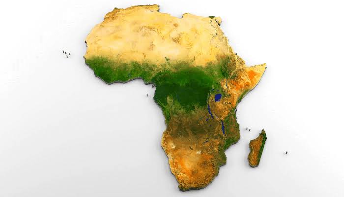
The United Nations General Assembly has, for the first time, formally endorsed a global shift away from the centuries-old Mercator map in favour of projections that show Africa—and other equatorial regions—in their true relative size. This “Correct the Map” resolution, spearheaded by Togo on behalf of the African Group and backed by the African Union, passed by 164 votes to one, with six abstentions. While non-binding, it marks a watershed moment in how the world visually represents the continent—and, by extension, how it perceives Africa’s weight in global affairs.
The root of the misrepresentation lies in the Mercator projection, devised in 1569 by Flemish cartographer Gerardus Mercator for maritime navigation. To keep compass bearings straight, Mercator preserved angles and shapes—but at the cost of area. The result: landmasses near the poles, such as Europe, North America and Greenland, are visually enlarged, while those near the equator, including Africa, Latin America and South Asia, are shrunk.
On typical Mercator wall maps, Greenland appears roughly the same size as Africa. In reality, Africa covers about 30.3 million square kilometres, making it around 14 times larger than Greenland’s 2.1 million square kilometres. This is not a minor quirk; it is a systematic visual bias baked into the most widely used world map for nearly five centuries.
The resolution encourages governments, schools, international organisations, media houses and technology companies to adopt equal-area projections, especially the Equal Earth projection, whenever comparative continental size matters. It frames map distortion as more than a technical issue—calling it a cognitive, educational, cultural and geopolitical problem that has contributed to the symbolic minimisation of Africa in the global imagination. While symbolic correction matters, Africa’s greatest vulnerabilities lie in structural exploitation and escalating insecurity, notably from Islamist insurgencies across the Sahel, Lake Chad Basin and parts of the Horn. Map reform must be paired with hard-edged action on multiple fronts.
First, curb external exploitation and illicit financial flows by tightening transparency on extractives, choking illicit financial flows through cross-border tax cooperation, and rebalancing investment terms to prioritise local content and value addition. Second, confront Islamist insecurity with a whole-of-system approach by funding and professionalising regional forces, targeting financing networks that fuel insurgencies, investing in governance at the frontier, and countering extremist narratives through community engagement.
Third, lock in development dividends that undercut recruitment by expanding vocational training and agro-processing corridors tied to the African Continental Free Trade Area (AfCFTA), funding climate-resilient livelihoods, and prioritising children’s education and primary healthcare. Fourth, reform global governance to reflect Africa’s weight by pressing for permanent African seats at the UN Security Council. The UN’s “Correct the Map” resolution is a necessary correction of a 450-year-old visual injustice.
But maps alone do not feed children, stop bullets or reclaim stolen wealth.
The post Right-sizing the map of Africa appeared first on Vanguard News.