

By Divinegeace Onosetale
There is a reality that has always shaped Lagos: water. From its creeks and lagoons to its wetlands, floodplains and drainage channels, water is woven into the city’s landscape.
But as Lagos grows and development spreads, some of the natural and planned pathways through which water moves are coming under increasing pressure.
A drainage setback becomes a shop. A fence creeps closer to a channel. An extension takes over another piece of open space. A wetland is filled and levelled, making way for a building.
At first, little appears to have changed. The building stands. Business continues. The land looks dry.
Then comes the rain
What seemed like a private decision about a piece of land can suddenly become a problem for an entire community. The water has nowhere to go when the rain comes. Roads become rivers. Houses take in water. Shops close. Traffic grinds to a halt. Businesses lose money as residents struggle to find their way through flooded streets.
And the question that follows is often the same: where did all the water come from? For Lagos, the answer is not always simply the amount of rainfall. Sometimes, attention turns to what happened to the spaces where the water was supposed to go.
In a city where land is highly valuable, protecting drainage corridors and other spaces needed to manage water is a continuing challenge.
Property owners resist demolition. Developers challenge enforcement. Residents worry about losing homes, businesses and investments. Government, too, faces difficult choices when structures have become homes, shops or sources of livelihood.
Lagos has seen the consequences when environmental concerns are left unresolved. The cost can eventually show up in flooded roads, damaged homes, disrupted businesses, lost livelihoods and, in some cases, displaced families.
That makes the issue larger than the removal of individual structures. It raises questions about where Lagos can build, where space must be preserved, and how the city can continue to expand without blocking the pathways through which its water moves.
Battle for drainage corridors
That struggle is increasingly playing out across Lagos as the state government moves to reclaim drainage rights of way and clear structures built along them.
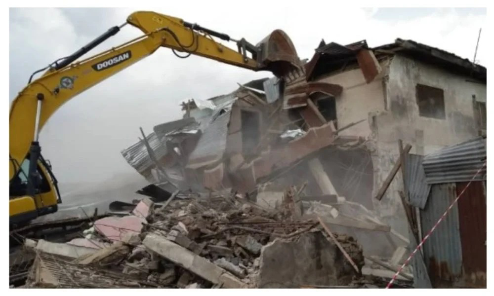
By April 2025, the government said it had removed 1,141 structures and other forms of encroachment in the previous year as part of efforts to recover drainage corridors.
The figure offers an indication of the scale of the problem. But beyond the number is a more fundamental question: what happens when a city gradually builds over infrastructure designed to carry its water away?
Across different parts of Lagos, the consequences are becoming increasingly visible.
Drainage is not just a collection of gutters and channels scattered across the city. It is a connected system designed to move rainwater from built-up areas towards rivers, lagoons and other waterways.
For that system to work, its channels must remain open and retain the width and routes for which they were designed.
Once one section is blocked or narrowed, the consequences can extend well beyond the property where the obstruction began.
A shop may take up only a few square metres of a drainage setback. A fence may occupy only a narrow strip. A building extension may appear too small to make much difference.
But across an entire neighbourhood, those small encroachments can add up.
The drainage capacity is reduced. The water slows down.
And water that should have passed through one area may end up in another person’s street.
That is how a private decision about land can become a public problem.
Lagos Island lesson
Around Lagos Island, the problem became particularly visible in early 2025. Government officials identified encroachments around the Bombata/Olusi and Alagbafo drainage collectors near the Apongbon axis, where shops and stalls had occupied spaces meant to serve as setbacks for the drainage infrastructure.
Notices were issued. Enforcement followed as part of the wider Lagos Island regeneration programme.
But beyond the demolition and clearance was a bigger challenge: how do you create space for drainage in one of the city’s oldest and busiest commercial districts, where almost every available piece of land has economic value? It is a difficult balance. Commerce needs space. Roads need space. Infrastructure needs space. Drainage needs space.
In Lagos Island, all four are competing for the same limited land. And the problem does not end there.
Move towards the Lekki corridor and another version of the same struggle emerges, this time driven by rapid urban development.
Lekki’s warning
Across Ogombo, Ikate, Kusenla and neighbouring communities, new estates, roads and commercial developments have transformed the landscape in recent years. But the rapid growth has also placed pressure on the natural and planned routes through which water moves.
In January 2026, officials inspecting the area said they had received information about encroachment on System 46, raising concerns that interference with the drainage route could affect the Ikota River corridor.
By June, renewed concerns about flooding led the government to order the removal of illegal structures obstructing drainage channels and rights of way around Agungi, Ajiran and Ikota.
Officials later reported improved stormwater flow after sections of the Ajiran drainage route towards the lagoon and Ikota River were reopened.
The development offered a practical lesson. When roads remain dry after heavy rainfall, few people stop to think about the channels carrying the water away.
But when those channels are blocked, narrowed or overwhelmed, their absence is suddenly felt.
Water backs up. Streets flood.And what was once hidden beneath the city’s development becomes impossible to ignore.
The bigger question
If structures continue to appear on drainage routes, floodplains and wetlands, it also raises questions about planning, approvals, monitoring and development control.
How are development approvals issued? How are drainage reservations identified and protected?
How does someone buying land know that the property is not sitting on a drainage corridor?
And when a building is later found to be on a restricted route, what information was available to the owner before construction began?These questions matter because not everyone facing demolition necessarily believes they have broken the law.
Some may have bought land through transactions they considered legitimate. Others may have obtained documents they believed gave them the right to build.
That is why drainage routes and other restricted areas need to be properly surveyed, clearly identified and documented.
Planning agencies also need accurate information to ensure that approvals do not conflict with existing drainage and environmental infrastructure. Most importantly, the rules need to be clear before construction begins.
A property owner should know the status of the land before investing in a building, not after the building is completed. Where government intends to restrict development, the boundaries need to be clear enough for citizens to understand.
Some spaces must stay open
There is another challenge, rooted partly in how Lagos views land. In a city where land is scarce and property prices are high, an undeveloped piece of land can easily be seen as a wasted opportunity.
An empty plot looks like land waiting for a building. But that is not always the case. Some spaces perform important functions even when nothing has been built on them.
A wetland can absorb excess water during heavy rainfall. A floodplain can provide space for water to spread instead of forcing it into homes and roads. A drainage setback can help preserve the capacity of a channel.
Empty, but not useless
The indiscriminate reclamation of such spaces can therefore have consequences beyond the land itself.
The concern was reflected in Lagos State’s decision in September 2025 to suspend indiscriminate reclamation projects. The government cited concerns over activities affecting wetlands, floodplains and lagoon fronts without the required environmental approvals.
The development highlights a broader concern for a city built around water: some open spaces serve functions that are not immediately visible. Wetlands, floodplains and drainage setbacks may appear undeveloped, but they can play a role in absorbing, storing or directing excess water.
Climate factor
The challenge becomes more pressing as rainfall patterns change and episodes of intense rainfall place greater pressure on the city’s drainage system.
Heavy rainfall can release large volumes of water within a short period. But where drainage channels have been narrowed, obstructed or built over, the available capacity to move that water is reduced.
A drainage reservation that may once have appeared unnecessarily wide can suddenly become critical during a severe downpour.
Similarly, wetlands and floodplains that appear undeveloped may provide important space for storing and absorbing excess water, helping to reduce pressure on homes, roads and other infrastructure.
The implications extend beyond development control. As intense rainfall places greater pressure on the city’s drainage system, the condition of these natural and planned water pathways is becoming an increasingly important part of how Lagos manages flood risk.
For a city exposed to flooding and other environmental pressures, preserving these pathways can help ensure that development does not compromise its ability to manage heavy rainfall in the years ahead.
Limits of demolition
The demolition of structures also raises questions about public confidence in environmental enforcement. For residents and property owners, the credibility of such enforcement can depend on whether the same planning and environmental rules are seen to apply across different categories of development.
Roadside traders, small property owners and major developments may occupy very different spaces in the city’s built environment, but where established rules are violated, the basis for enforcement should be clear.
This does not make every demolition wrong, nor does it make every government action beyond question. Enforcement should be guided by clear rules, technical evidence and due process, with room for review where errors occur. The number of structures removed, therefore, tells only part of the story. Equally important is how clearly the rules are defined, communicated and applied.
Before the bulldozers
By the time a bulldozer arrives at a completed building, questions about planning, approval, monitoring and enforcement may already have arisen. A different outcome is possible when drainage routes, wetlands and floodplains are identified and protected before construction begins.
For Lagos, where development continues to push into previously undeveloped areas, the challenge is increasingly about how to accommodate growth while retaining the spaces through which water moves.
More homes will be built. Roads and commercial districts will expand. Pressure on land will continue.But the water will still need somewhere to go.
The effectiveness of environmental planning may therefore be seen not only in the structures that are removed, but in the structures that are never allowed to obstruct critical environmental infrastructure in the first place.The goal should be a Lagos where bulldozers become increasingly unnecessary because critical environmental infrastructure is protected from development in the first place.
Onosetale, a journalist writes from Lagos
The post When Lagos builds where water flows appeared first on Vanguard News.