

The United Nations General Assembly (UNGA) has adopted an African-backed proposal seeking a new world map that more accurately reflects the relative sizes of countries and regions.
The resolution, adopted on Friday, calls for a more “equitable” representation of the world, with particular emphasis on correcting the perceived underrepresentation of Africa in conventional world maps.
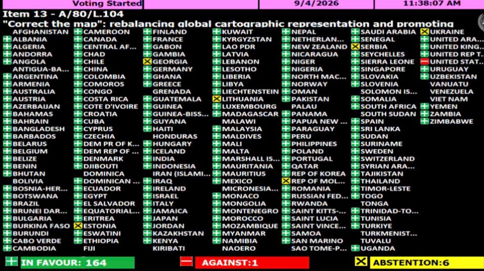
It was adopted with 164 countries voting in favour, while six countries abstained and the United States voted against it.
Those that abstained were Ukraine, Estonia, Lithuania, Georgia, Moldova and Serbia.
According to the resolution, distortions in widely used world maps have contributed to the “symbolic minimization” of Africa and other regions in the collective imagination.
Many maps currently in use are based on the Mercator projection, developed by European cartographer Gerardus Mercator in 1569 primarily to assist navigation at sea.
The projection transferred the curved surface of the globe onto a flat map, resulting in significant distortions in the size of countries, particularly those located farther from the Equator.
Although the Mercator projection remains widely used in classrooms and some navigation and mapping systems, its depiction of countries has long been criticised for making regions in the northern and southern extremes appear considerably larger than their actual land areas.
The African Union (AU), alongside other advocacy groups, has backed efforts under the “Correct the Map” campaign to promote alternatives to the centuries-old projection.
The campaign seeks greater public awareness of how different map projections influence perceptions of the relative size and importance of countries and regions.
The adopted resolution expressed concern that distortions in conventional maps contribute to minimising the perceived size of Africa, Latin America and South Asia and could perpetuate an unbalanced view of the world.
It further noted that such distortions could contribute to misconceptions about the socioeconomic realities, infrastructure needs, development potential and prosperity of regions in the Global South.
The resolution also warned that inaccurate visual representations could reinforce prejudices in environmental, geopolitical and security discourse.
The move marks a renewed push for a world map that presents a more proportionate visual representation of the planet’s regions and challenges long-standing conventions in global cartography.
The post UN adopts African-backed proposal for new world map appeared first on Vanguard News.